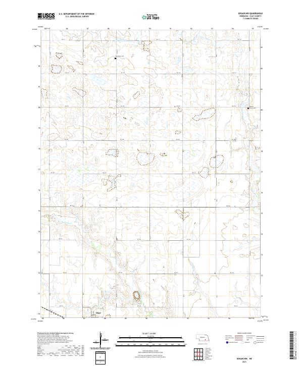
2021 Map of Edgar NW
USGS Topo · Published 2021About this map
Agricultural grid patterns and gentle drainage basins characterize this Clay County landscape in the early 2020s. The southern edge of the survey captures the northern outskirts of Edgar, where 8th St meets the rural road network. The terrain is defined by the headwaters and meandering paths of Big Sandy Creek and Little Sandy Creek, which cut across the predominantly rectangular township divisions of t6n r6w and t5n r6w. This map is particularly valuable for genealogical research, identifying the Evergreen Cem in the north and the Grove Cem Chapel near the eastern boundary. These sites, along with the numerous section-line roads like Rd 311 and Rd Q, provide a clear spatial framework for locating ancestral family farms and township boundaries that have structured this Nebraska prairie for generations.
Find a feature on this map
28 named features on this map. Tap any name to fly to it.
Don’t see what you’re looking for? This feature index may not catch every label — zoom into the map to look around manually.
Map Details
Editions of this 2021 Edgar NW Map
This is the sole edition of this map. No revisions or reprints were ever made.
Other maps of this area

1898 · York
USGS Topo · 1:125,000

1898 · Superior
USGS Topo · 1:125,000

1898 · Hebron
USGS Topo · 1:125,000

1898 · Grand Island
USGS Topo · 1:125,000

1899 · York
USGS Topo · 1:125,000

1955 · Lincoln
USGS Topo · 1:250,000

1955 · Grand Island
USGS Topo · 1:250,000

1957 · Lincoln
USGS Topo · 1:250,000

1957 · Grand Island
USGS Topo · 1:250,000

1958 · Grand Island
USGS Topo · 1:250,000