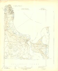
1944 Map of Edgartown
USGS Topo · Published 1944About this map
Edgartown and the eastern shores of Martha’s Vineyard appear in high detail during the early 1940s, revealing a landscape defined by its coastal geography and early aviation infrastructure. The map documents the sprawling Chappaquiddick Island to the east, separated from the main town by Edgartown Harbor and bounded by the waters of Cape Poge Bay. Significant maritime landmarks, including the East Chop Lighthouse, Edgartown Lighthouse, and Cape Poge Lighthouse, mark the shoreline, while the interior shows the transition of the island's economy with the presence of both the Edgartown Airport and Oak Bluffs Airport.
Find a feature on this map
102 named features on this map. Tap any name to fly to it.
Don’t see what you’re looking for? This feature index may not catch every label — zoom into the map to look around manually.
Map Details
Editions of this 1944 Edgartown Map
3 editions found
Other maps of this area

1887 · Marthas Vineyard
USGS Topo · 1:62,500

1889 · Marthas Vineyard
USGS Topo · 1:62,500

1894 · Marthas Vineyard
USGS Topo · 1:62,500

1942 · Marthas Vineyard
USGS Topo · 1:125,000

1942 · Nantucket
USGS Topo · 1:125,000

1944 · Tisbury Great Pond
USGS Topo · 1:31,680

1944 · Vineyard Haven
USGS Topo · 1:31,680

1947 · Providence
USGS Topo · 1:250,000

1948 · Providence
USGS Topo · 1:250,000
1951 · Edgartown
USGS Topo · 1:31,680