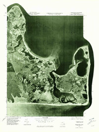
1977 Map of Edgartown
USGS Topo · Published 1981About this map
Marthas Vineyard is captured here through 1970s orthophotography, revealing the intricate shoreline and settlement patterns of the island's eastern reaches. The primary village of Edgartown sits centrally, anchoring a landscape where dense coastal developments like Oak Bluffs and Harthaven give way to the more open, sandy expanses of Chappaquiddick Island. Smaller local settlements such as Jerneganville and Katama are visible as they were just before the close of the decade, showing the established road networks and residential footprints of the era.
Find a feature on this map
11 named features on this map. Tap any name to fly to it.
Don’t see what you’re looking for? This feature index may not catch every label — zoom into the map to look around manually.
Map Details
Editions of this 1977 Edgartown Map
This is the sole edition of this map. No revisions or reprints were ever made.
Other maps of this area

1887 · Marthas Vineyard
USGS Topo · 1:62,500

1889 · Marthas Vineyard
USGS Topo · 1:62,500

1894 · Marthas Vineyard
USGS Topo · 1:62,500

1942 · Marthas Vineyard
USGS Topo · 1:125,000

1942 · Nantucket
USGS Topo · 1:125,000

1944 · Tisbury Great Pond
USGS Topo · 1:31,680

1944 · Vineyard Haven
USGS Topo · 1:31,680
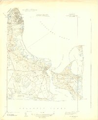
1944 · Edgartown
USGS Topo · 1:31,680

1947 · Providence
USGS Topo · 1:250,000

1948 · Providence
USGS Topo · 1:250,000