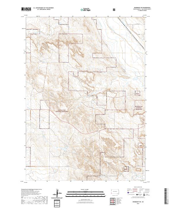
2021 Map of Edgemont SW
USGS Topo · Published 2021About this map
Buffalo Gap National Grassland dominates this portion of Fall River County, where the plains are defined by an intricate network of seasonal drainage and water management. The Cheyenne River flows through the northeast, joined by smaller tributaries like Driftwood Cr and Dry Cr. Evidence of ranching and irrigation infrastructure is clear, notably the presence of the Tubbs Canal and the Fiddle Cr Reservoir. These features, alongside named drainages such as Moss Agate Cr and Cottonwood Cr, illustrate the fundamental importance of water rights and land use in this arid South Dakota landscape. The map provides a detailed view of the section lines and rural routes, including Co Hwy 8 E and River Rd, that provide access to these expansive public and private lands.
Find a feature on this map
22 named features on this map. Tap any name to fly to it.
Don’t see what you’re looking for? This feature index may not catch every label — zoom into the map to look around manually.
Map Details
Editions of this 2021 Edgemont SW Map
This is the sole edition of this map. No revisions or reprints were ever made.
Other maps of this area

1902 · Edgemont
USGS Topo · 1:125,000

1950 · Edgemont
USGS Topo · 1:24,000

1950 · Edgemont SW
USGS Topo · 1:24,000

1950 · Burdock
USGS Topo · 1:24,000

1950 · Edgemont NE
USGS Topo · 1:24,000

1951 · Twentyone Divide
USGS Topo · 1:24,000

1955 · Hot Springs
USGS Topo · 1:250,000

1955 · Newcastle
USGS Topo · 1:250,000

1958 · Newcastle
USGS Topo · 1:250,000

1978 · Coffee Flats
USGS Topo · 1:24,000