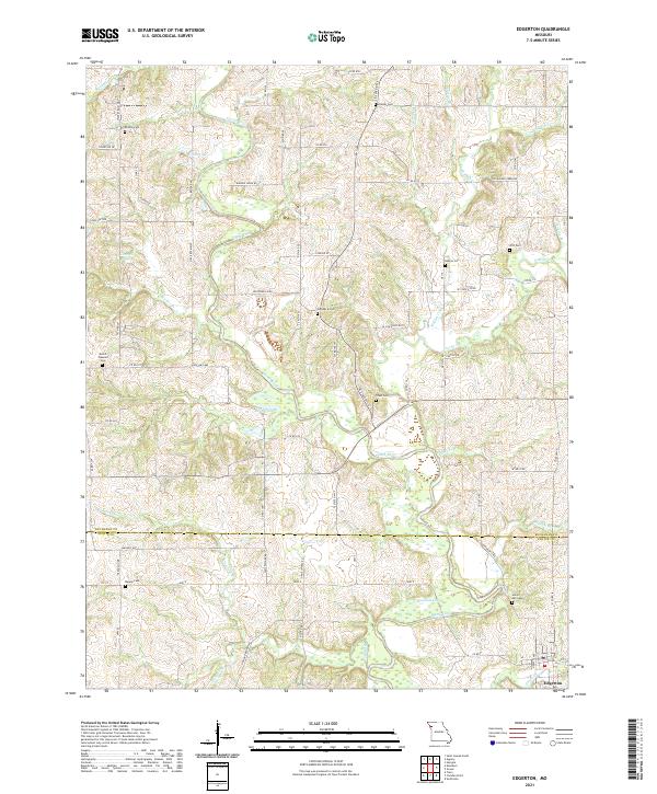
2021 Map of Edgerton
USGS Topo · Published 2021About this map
The Platte River meanders across this rural landscape where the Buchanan Co and Platte Co lines meet in western Missouri. The town of Edgerton serves as the primary settlement hub in the southeast corner, anchored by a network of local routes like Hwy Z and State Hwy MM. This region is characterized by a high density of ancestral burial grounds, including the Union Mill Cem and Maupin Cem, which offer significant value for genealogical research in this part of the state.
Find a feature on this map
78 named features on this map. Tap any name to fly to it.
Don’t see what you’re looking for? This feature index may not catch every label — zoom into the map to look around manually.
Map Details
Editions of this 2021 Edgerton Map
This is the sole edition of this map. No revisions or reprints were ever made.
Other maps of this area

1890 · Kansas City
USGS Topo · 1:125,000

1894 · Kansas City
USGS Topo · 1:125,000

1910 · Leavenworth
USGS Topo · 1:62,500

1914 · Smithville
USGS Topo · 1:62,500

1925 · Gower
USGS Topo · 1:62,500

1927 · Dearborn
USGS Topo · 1:62,500

1948 · Leavenworth
USGS Topo · 1:62,500

1950 · Kansas City
USGS Topo · 1:250,000
1950 · Smithville
USGS Topo · 1:62,500
1951 · Smithville
USGS Topo · 1:24,000