
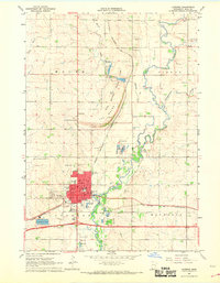
1967 Map of Edgerton South
USGS Topo · Published 1968About this map
Edgerton and Hardwick anchor this prairie landscape in the late 1960s, a region defined by the diagonal transit of the Chicago Rock Island and Pacific railroad. The terrain transitions from the rolling drainages of Poplar Creek and Chanarambie Creek in the north to the broad expanse of the Battle Plain further south.
Find a feature on this map
19 named features on this map. Tap any name to fly to it.
Don’t see what you’re looking for? This feature index may not catch every label — zoom into the map to look around manually.
Map Details
Editions of this 1967 Edgerton South Map
This is the sole edition of this map. No revisions or reprints were ever made.
Other maps of this area

1955 · Sioux Falls
USGS Topo · 1:250,000

1958 · Sioux Falls
USGS Topo · 1:250,000

1967 · Magnolia
USGS Topo · 1:24,000

1967 · Edgerton North
USGS Topo · 1:24,000

1967 · Edgerton NE
USGS Topo · 1:24,000

1967 · Kenneth
USGS Topo · 1:24,000

1967 · Jasper SE
USGS Topo · 1:24,000

1967 · Hills NE
USGS Topo · 1:24,000

1967 · Pipestone South
USGS Topo · 1:24,000
1967 · Luverne
USGS Topo · 1:24,000