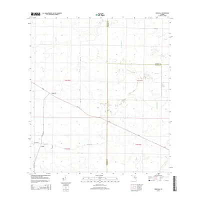
2015 Map of Edgeville
USGS Topo · Published 2015About this map
Edgeville and Sandy define the rural character of this landscape in eastern Manatee County, where the topography is shaped by an intricate network of waterways. The drainage pattern is dominated by Owen Cr and Owen Br in the north, while the southern reaches are marked by slow-moving features like Wildcat Slough and Bud Slough. This region, where the borders of Hardee and DeSoto counties meet, reveals a traditional Florida ranching or agricultural layout, evidenced by the large township and range blocks and a series of long-standing rural routes. Notable thoroughfares such as Sugar Bowl Rd and Clay Gully Rd cut through the terrain, connecting isolated homesteads. The prominence of Buzzard Roost Br in the east suggests a landscape defined by seasonal wetlands and small tributaries that have historically dictated the placement of settlements and roads in this part of the state.
Find a feature on this map
22 named features on this map. Tap any name to fly to it.
Don’t see what you’re looking for? This feature index may not catch every label — zoom into the map to look around manually.
Map Details
Editions of this 2015 Edgeville Map
This is the sole edition of this map. No revisions or reprints were ever made.
Other maps of this area

1956 · Ona
USGS Topo · 1:24,000

1956 · Myakka City
USGS Topo · 1:24,000

1956 · Edgeville
USGS Topo · 1:24,000

1956 · Myakka City NW
USGS Topo · 1:24,000

1956 · Murdock NE
USGS Topo · 1:24,000

1956 · Myakka Head
USGS Topo · 1:24,000

1956 · Limestone
USGS Topo · 1:24,000

1956 · Nocatee
USGS Topo · 1:24,000

1956 · Murdock NW
USGS Topo · 1:24,000

1956 · Tampa
USGS Topo · 1:250,000