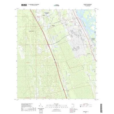
2021 Map of Edgewater
USGS Topo · Published 2021About this map
Edgewater and the southern reaches of New Smyrna Beach are defined by the intricate waterways separating the Florida mainland from the Canaveral National Seashore. The landscape is a complex network of wetlands and tidal passages, including the Intracoastal Waterway, Indian River Lagoon, and Spruce Creek Swamp. Historic rail infrastructure is preserved through the East Central Regional Rail-Trl, which follows the corridor through Edgewater Junction down toward Creighton. Local genealogy and land use are visible through features like the Clinton Family Cem and the legacy of citrus cultivation suggested by names like Citrus Dr and Brown Grove Rd. This contemporary survey documents the transition from established settlements like Glencoe and Hucomer to the protected coastal environments of Sand Point and the Three Sisters Islands.
Find a feature on this map
127 named features on this map. Tap any name to fly to it.
Don’t see what you’re looking for? This feature index may not catch every label — zoom into the map to look around manually.
Map Details
Editions of this 2021 Edgewater Map
This is the sole edition of this map. No revisions or reprints were ever made.
Other maps of this area

1937 · Port Orange
USGS Topo · 1:48,000

1943 · Port Orange
USGS Topo · 1:62,500

1944 · Port Orange
USGS Topo · 1:62,500

1949 · Oak Hill
USGS Topo · 1:24,000

1949 · Osceola
USGS Topo · 1:24,000

1950 · Maytown
USGS Topo · 1:24,000

1950 · Ariel
USGS Topo · 1:24,000

1950 · Edgewater
USGS Topo · 1:24,000

1952 · Samsula
USGS Topo · 1:24,000

1954 · Daytona Beach
USGS Topo · 1:250,000