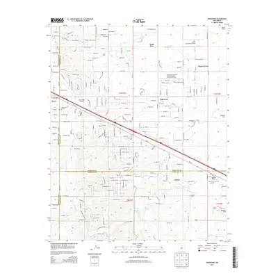
2013 Map of Edgewood
USGS Topo · Published 2013About this map
Edgewood and the surrounding high plains of the Estancia Valley are defined by a network of ranching legacies and modern aviation in this early 21st-century record. The map captures a transitional landscape where historic family holdings like the Bassett Ranch, Lyod Ranch, and H S Williams Ranch coexist with emerging residential developments and specialized airfields such as the Sandia Airpark Estates East Airport and the New Mexico Soaring Ranch Airport. The community of Barton sits near the western edge, while the southern reaches transition toward the YMCA Camp near Arroyo de San Jose. This survey is particularly useful for identifying the specific locations of rural homesteads like Briggs Place and Jarett Place, providing a clear view of the complex county boundaries where Santa Fe and Torrance counties meet.
Find a feature on this map
222 named features on this map. Tap any name to fly to it.
Don’t see what you’re looking for? This feature index may not catch every label — zoom into the map to look around manually.
Map Details
Editions of this 2013 Edgewood Map
This is the sole edition of this map. No revisions or reprints were ever made.
Other maps of this area

1892 · San Pedro
USGS Topo · 1:125,000

1917 · Estancia
USGS Topo · 1:125,000

1954 · Chilili
USGS Topo · 1:24,000

1954 · Sandia Park
USGS Topo · 1:24,000

1954 · San Pedro
USGS Topo · 1:24,000

1954 · Sedillo
USGS Topo · 1:24,000

1954 · Escabosa
USGS Topo · 1:24,000

1954 · Edgewood
USGS Topo · 1:24,000

1954 · Socorro
USGS Topo · 1:250,000

1956 · Edgewood
USGS Topo · 1:62,500