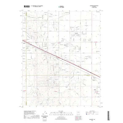
2020 Map of Edgewood
USGS Topo · Published 2020About this map
Edgewood serves as the central hub of this high-desert landscape, where the convergence of Santa Fe, Torrance, and Bernalillo counties shapes the local geography. The map documents a sprawling suburban-rural transition, most notably at Sandia Airpark Estates East, which highlights the area's integration of aviation and residential life. To the west, the settlement of Barton sits near the head of Juan-Tomas Canyon, while the Mountain Valley Cem provides a point of genealogical interest for local researchers. The southern portion of the quadrangle is defined by the winding course of the Arroyo de San Jose and the rugged topography of Cañon de Gallegos. A dense network of named roads like Rattlesnake Run and Quarter Moon Hill reveals the extensive residential development that has transformed these once-open range lands east of the Sandia Mountains.
Find a feature on this map
141 named features on this map. Tap any name to fly to it.
Don’t see what you’re looking for? This feature index may not catch every label — zoom into the map to look around manually.
Map Details
Editions of this 2020 Edgewood Map
This is the sole edition of this map. No revisions or reprints were ever made.
Other maps of this area

1892 · San Pedro
USGS Topo · 1:125,000

1917 · Estancia
USGS Topo · 1:125,000

1954 · Chilili
USGS Topo · 1:24,000

1954 · Sandia Park
USGS Topo · 1:24,000

1954 · San Pedro
USGS Topo · 1:24,000

1954 · Sedillo
USGS Topo · 1:24,000

1954 · Escabosa
USGS Topo · 1:24,000

1954 · Edgewood
USGS Topo · 1:24,000

1954 · Socorro
USGS Topo · 1:250,000

1956 · Edgewood
USGS Topo · 1:62,500