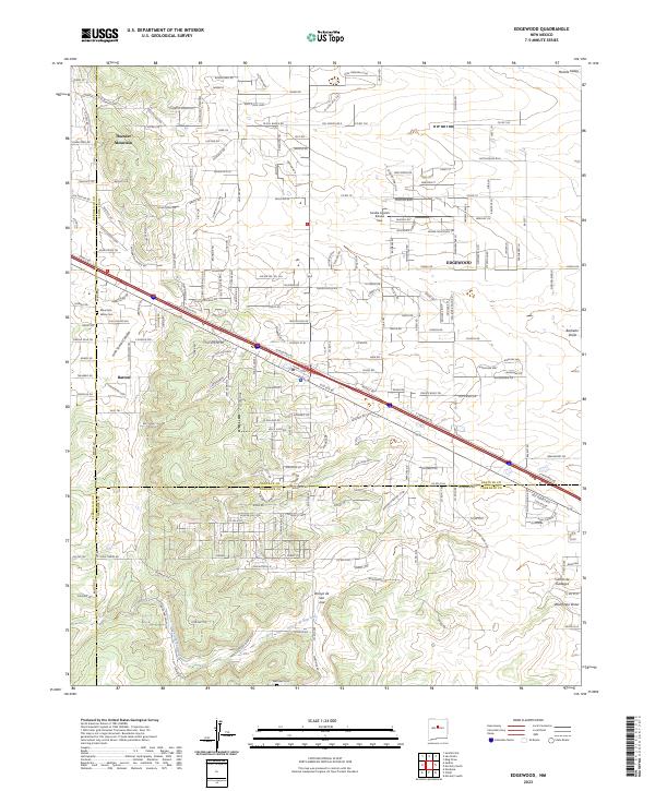
2023 Map of Edgewood
USGS Topo · Published 2023About this map
Edgewood and the surrounding high-desert plateau of the Estancia Valley serve as the focal point for this contemporary survey at the intersection of Santa Fe, Bernalillo, and Torrance counties. The area is defined by a dense network of county roads and residential developments like Sandia Airpark Estates East and Homes Valley, reflecting the modern expansion of these communities. Historical traces remain visible in the placement of Mountain Valley Cem near Barton and the Martinez Cem situated along the southern reaches near the Arroyo de San Jose.
Find a feature on this map
226 named features on this map. Tap any name to fly to it.
Don’t see what you’re looking for? This feature index may not catch every label — zoom into the map to look around manually.
Map Details
Editions of this 2023 Edgewood Map
This is the sole edition of this map. No revisions or reprints were ever made.
Historical Maps of Douglas Through Time
4 maps found