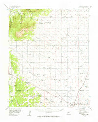
1956 Map of Edgewood
USGS Topo · Published 1963About this map
The San Pedro Mountains and South Mountain dominate the northwestern corner of this mid-century New Mexico landscape, giving way to the lower grazing lands of Homes Valley. The region is defined by a dense network of family-held homesteads and ranches, such as the Simmons Ranch, Briggs Place, and Van Scoyk Ranch, reflecting the rural livestock economy of the era. Settlement is concentrated near Edgewood and the village of San Pedro, where historic Mine Tailings near Oro Quay Peak point to the area's extraction history. Transportation patterns are evidenced by the Old Railroad Grade and a prominent Telephone Line cutting across the central plains. In the southeast, near Moriarty, the presence of the Otto Airfield Beacon suggests the growing importance of regional aviation infrastructure during the 1950s.
Find a feature on this map
63 named features on this map. Tap any name to fly to it.
Don’t see what you’re looking for? This feature index may not catch every label — zoom into the map to look around manually.
Map Details
Editions of this 1956 Edgewood Map
3 editions found

Other maps of this area

1892 · San Pedro
USGS Topo · 1:125,000

1894 · Lamy
USGS Topo · 1:125,000

1917 · Estancia
USGS Topo · 1:125,000

1954 · Chilili
USGS Topo · 1:24,000

1954 · Sandia Park
USGS Topo · 1:24,000

1954 · San Pedro
USGS Topo · 1:24,000

1954 · Sedillo
USGS Topo · 1:24,000

1954 · Hagan
USGS Topo · 1:24,000

1954 · Escabosa
USGS Topo · 1:24,000

1954 · Edgewood
USGS Topo · 1:24,000