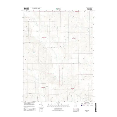
2015 Map of Edina SE
USGS Topo · Published 2015About this map
Bee Ridge sits at the center of this rural landscape in Knox County, where the dendritic drainage of the South Fabius River and Little Fabius River shapes the land. The terrain is characterized by a dense network of county roads, such as CR-277 and CR-303, which navigate the many tributaries including Troublesome Cr and Cottey Cr. This 2015 survey illustrates a contemporary agricultural region still anchored by its historical landmarks. Genealogists and local historians will find the Coe Cemetery in the southern portion of the map, situated near several family-named water features like Miller Lake and Wamsley Lake. The map reveals how the modern grid of rural routes continues to follow the natural contours of the river basins and creek beds like Coon Cr and Long Br.
Find a feature on this map
65 named features on this map. Tap any name to fly to it.
Don’t see what you’re looking for? This feature index may not catch every label — zoom into the map to look around manually.
Map Details
Editions of this 2015 Edina SE Map
This is the sole edition of this map. No revisions or reprints were ever made.
Other maps of this area
1903 · Kahoka
USGS Topo · 1:125,000
1903 · Palmyra
USGS Topo · 1:125,000
1903 · Edina
USGS Topo · 1:125,000
1948 · Quincy
USGS Topo · 1:250,000
1950 · La Belle
USGS Topo · 1:24,000
1951 · La Belle
USGS Topo · 1:24,000
1951 · Deer Ridge
USGS Topo · 1:24,000
1953 · Moberly
USGS Topo · 1:250,000
1954 · Centerville
USGS Topo · 1:250,000
1954 · Moberly
USGS Topo · 1:250,000