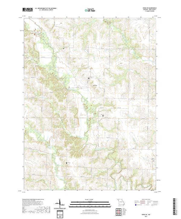
2021 Map of Edina SE
USGS Topo · Published 2021About this map
Bee Ridge and its surrounding countryside define the rural character of this Knox County landscape. The geography is shaped by the parallel drainage of the South Fabius River and the Little Fabius River, which create a dissected terrain of ridges and valleys. Numerous family and community burial sites are scattered throughout these uplands, including Todd Cem, Snell Cem, and Coe Cem.
Find a feature on this map
59 named features on this map. Tap any name to fly to it.
Don’t see what you’re looking for? This feature index may not catch every label — zoom into the map to look around manually.
Map Details
Editions of this 2021 Edina SE Map
This is the sole edition of this map. No revisions or reprints were ever made.
Other maps of this area

1903 · Kahoka
USGS Topo · 1:125,000

1903 · Palmyra
USGS Topo · 1:125,000

1903 · Edina
USGS Topo · 1:125,000

1948 · Quincy
USGS Topo · 1:250,000

1950 · La Belle
USGS Topo · 1:24,000

1951 · La Belle
USGS Topo · 1:24,000
1951 · Deer Ridge
USGS Topo · 1:24,000

1953 · Moberly
USGS Topo · 1:250,000

1954 · Centerville
USGS Topo · 1:250,000

1954 · Moberly
USGS Topo · 1:250,000