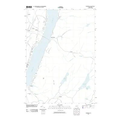
2010 Map of Edinburg
USGS Topo · Published 2010About this map
Great Sacandaga Lake dominates this northern Saratoga County landscape, reflecting the modern shoreline that reshaped the valley. The settlement of Edinburg sits along the western bank, flanked by Edinburg Cemetery and the Plateau Sky Ranch. Moving south, the water widens past the Brooks Cemetery and the high point at Bald Bluff, where the Sacandaga River flows toward the reservoir's deeper reaches.
Find a feature on this map
54 named features on this map. Tap any name to fly to it.
Don’t see what you’re looking for? This feature index may not catch every label — zoom into the map to look around manually.
Map Details
Editions of this 2010 Edinburg Map
This is the sole edition of this map. No revisions or reprints were ever made.
Other maps of this area

1899 · Broadalbin
USGS Topo · 1:62,500

1902 · Broadalbin
USGS Topo · 1:62,500

1902 · Saratoga
USGS Topo · 1:62,500

1903 · Luzerne
USGS Topo · 1:62,500

1910 · Stony Creek
USGS Topo · 1:62,500

1935 · Middle Grove
USGS Topo · 1:24,000

1942 · Saratoga
USGS Topo · 1:62,500

1945 · Edinburg
USGS Topo · 1:24,000
1945 · Galway
USGS Topo · 1:24,000

1945 · Northville
USGS Topo · 1:24,000