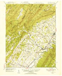
1951 Map of Edinburg
USGS Topo · Published 1951About this map
The North Fork of the Shenandoah River carves a winding path through the valley in this mid-century survey, defining the industrial and agricultural corridors of Shenandoah County. Settlement patterns follow the river and the Southern Railway, with established towns like Edinburg and Woodstock serving as local hubs. The map reveals a legacy of early industry along the mountain flanks, evidenced by several historic iron works including Van Buren Furnace, Columbia Furnace, and Liberty Furnace.
Find a feature on this map
94 named features on this map. Tap any name to fly to it.
Don’t see what you’re looking for? This feature index may not catch every label — zoom into the map to look around manually.
Map Details
Editions of this 1951 Edinburg Map
This is the sole edition of this map. No revisions or reprints were ever made.
Other maps of this area

1891 · Romney
USGS Topo · 1:125,000

1892 · Woodstock
USGS Topo · 1:125,000

1893 · Luray
USGS Topo · 1:125,000

1894 · Winchester
USGS Topo · 1:125,000

1905 · Luray
USGS Topo · 1:125,000

1920 · Moorefield
USGS Topo · 1:62,500

1921 · Orkney Springs
USGS Topo · 1:48,000

1921 · Moorefield
USGS Topo · 1:48,000

1922 · Moorefield
USGS Topo · 1:62,500

1922 · Wardensville
USGS Topo · 1:62,500