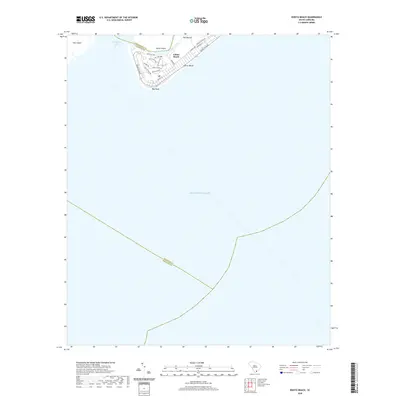
2020 Map of Edisto Beach
USGS Topo · Published 2020About this map
Edisto Island and the coastal community of Edisto Beach sit at the southern tip of the South Carolina Lowcountry, bounded by the South Edisto Inlet and the Atlantic Ocean. This recent survey documents the detailed residential layout of the beach town, where thoroughfares like Palmetto Blvd and Jungle Rd define the local grid. The map reveals the intricate network of tidal waterways such as Big Bay Creek and Scott Creek that separate the main island from Pine Island. Local landmarks such as The Mound and Bay Point are clearly marked, alongside neighborhood-specific streets like Oristo Ridge and Sea Cloud Cir, illustrating the modern development of this barrier island landscape.
Find a feature on this map
27 named features on this map. Tap any name to fly to it.
Don’t see what you’re looking for? This feature index may not catch every label — zoom into the map to look around manually.
Map Details
Editions of this 2020 Edisto Beach Map
This is the sole edition of this map. No revisions or reprints were ever made.
Other maps of this area

1919 · Edisto Island
USGS Topo · 1:62,500

1919 · Wadmelaw Island
USGS Topo · 1:62,500

1920 · St. Helena Sound
USGS Topo · 1:62,500

1943 · Edisto Island
USGS Topo · 1:62,500

1944 · Wadmelaw Island
USGS Topo · 1:62,500

1947 · Savannah
USGS Topo · 1:250,000

1948 · St. Helena Sound
USGS Topo · 1:62,500

1948 · Savannah
USGS Topo · 1:250,000
1956 · Edisto Beach
USGS Topo · 1:24,000
1956 · St. Helena Sound
USGS Topo · 1:24,000