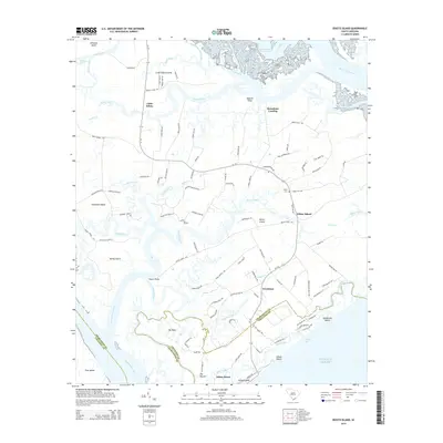
2014 Map of Edisto Island
USGS Topo · Published 2014About this map
Edisto Island and its surrounding coastal geography are defined by a complex network of salt marshes, tidal creeks, and historic landings. The landscape is anchored by settlements such as Little Edisto, Freedman, and the coastal communities of Edisto Beach and Edingsville Beach. This modern survey records the enduring layout of the Sea Islands, where the South Edisto River and North Edisto River meet the Atlantic Ocean. Significant cultural landmarks like Trinity Cem and Steamboat Landing reflect generations of local history and maritime reliance.
Find a feature on this map
113 named features on this map. Tap any name to fly to it.
Don’t see what you’re looking for? This feature index may not catch every label — zoom into the map to look around manually.
Map Details
Editions of this 2014 Edisto Island Map
This is the sole edition of this map. No revisions or reprints were ever made.
Other maps of this area

1919 · Edisto Island
USGS Topo · 1:62,500

1919 · Wadmelaw Island
USGS Topo · 1:62,500

1920 · St. Helena Sound
USGS Topo · 1:62,500

1943 · Edisto Island
USGS Topo · 1:62,500

1944 · Wadmelaw Island
USGS Topo · 1:62,500

1947 · Savannah
USGS Topo · 1:250,000

1948 · St. Helena Sound
USGS Topo · 1:62,500

1948 · Savannah
USGS Topo · 1:250,000
1956 · Edisto Beach
USGS Topo · 1:24,000
1956 · St. Helena Sound
USGS Topo · 1:24,000