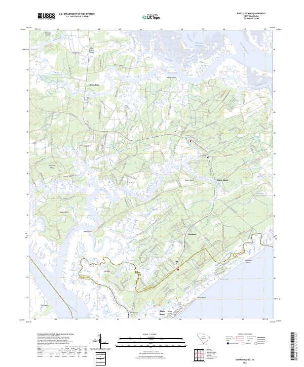
2024 Map of Edisto Island
USGS Topo · Published 2024About this map
Ernest F Hollings ACE Basin National Wildlife Refuge anchors the northwestern corner of this landscape, where the tides of the South Edisto River and North Edisto River define a complex network of barrier islands and salt marshes. The interior of Edisto Island reveals a legacy of agricultural and spiritual life, centered on the Trinity Episcopal Church Cem and the settlement of Freedman. Small islands like Jehossee Island and Little Edisto Island remain separated by intricate tidal cuts such as Watts Cut and Whooping Island Creek.
Find a feature on this map
120 named features on this map. Tap any name to fly to it.
Don’t see what you’re looking for? This feature index may not catch every label — zoom into the map to look around manually.
Map Details
Editions of this 2024 Edisto Island Map
This is the sole edition of this map. No revisions or reprints were ever made.
Other maps of this area

1919 · Edisto Island
USGS Topo · 1:62,500

1919 · Wadmelaw Island
USGS Topo · 1:62,500

1920 · St. Helena Sound
USGS Topo · 1:62,500

1943 · Edisto Island
USGS Topo · 1:62,500

1944 · Wadmelaw Island
USGS Topo · 1:62,500

1947 · Savannah
USGS Topo · 1:250,000

1948 · St. Helena Sound
USGS Topo · 1:62,500

1948 · Savannah
USGS Topo · 1:250,000
1956 · Edisto Beach
USGS Topo · 1:24,000
1956 · St. Helena Sound
USGS Topo · 1:24,000