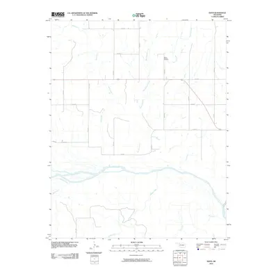
2010 Map of Edith
USGS Topo · Published 2010About this map
The Cimarron River carves a wide, braided path through this portion of Woods County, defining the local hydrology and landscape. The river is joined by several significant tributaries, including Sand Creek, Moccasin Creek, and Traders Creek, which drain the surrounding plains. This topography is characteristic of the region's river valley systems, where seasonal water flow has historically shaped movement and settlement.
Find a feature on this map
25 named features on this map. Tap any name to fly to it.
Don’t see what you’re looking for? This feature index may not catch every label — zoom into the map to look around manually.
Map Details
Editions of this 2010 Edith Map
This is the sole edition of this map. No revisions or reprints were ever made.
Other maps of this area

1955 · Woodward
USGS Topo · 1:250,000

1958 · Woodward
USGS Topo · 1:250,000

1970 · Alabaster Caverns
USGS Topo · 1:24,000

1970 · Lookout
USGS Topo · 1:24,000

1970 · Freedom NE
USGS Topo · 1:24,000

1970 · Fairvalley
USGS Topo · 1:24,000

1970 · Freedom NW
USGS Topo · 1:24,000

1970 · Edith
USGS Topo · 1:24,000
1970 · Freedom
USGS Topo · 1:24,000

1971 · Selman SE
USGS Topo · 1:24,000