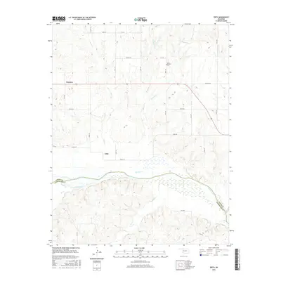
2016 Map of Edith
USGS Topo · Published 2016About this map
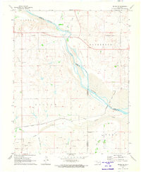
The Cimarron River carves a significant course across this portion of Northwest Oklahoma, defining the boundary between Woods County and Woodward County. This rural landscape is characterized by a network of drainage systems including Sand Creek, Moccasin Creek, and Traders Creek, which feed into the primary river valley. The small settlements of Edith and Plainview serve as local hubs for the surrounding agricultural area, connected by a grid of section line roads such as Jefferson Road and Haskell Road. Genealogists and local historians will find the Mount Pleasant Cemetery situated in the northern hills, a quiet marker of the community's heritage amidst the rugged terrain of the Cimarron breaks. The map captures the specialized hydrology of the region, showing seasonal watercourses like Buffalo Creek and Elm Creek as they negotiate the elevation changes typical of this prairie landscape.
Find a feature on this map
32 named features on this map. Tap any name to fly to it.
Don’t see what you’re looking for? This feature index may not catch every label — zoom into the map to look around manually.
Map Details
Editions of this 2016 Edith Map
This is the sole edition of this map. No revisions or reprints were ever made.
Other maps of this area

1955 · Woodward
USGS Topo · 1:250,000

1958 · Woodward
USGS Topo · 1:250,000
1970 · Alabaster Caverns
USGS Topo · 1:24,000
1970 · Lookout
USGS Topo · 1:24,000
1970 · Freedom NE
USGS Topo · 1:24,000
1970 · Fairvalley
USGS Topo · 1:24,000
1970 · Freedom NW
USGS Topo · 1:24,000
1970 · Edith
USGS Topo · 1:24,000
1970 · Freedom
USGS Topo · 1:24,000
1971 · Selman SE
USGS Topo · 1:24,000