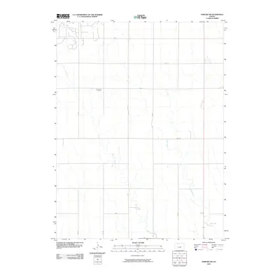
2009 Map of Edmond NW
USGS Topo · Published 2009About this map
Prairie Gem Cemetery serves as a central landmark in this portion of Norton County, situated amidst a landscape defined by the drainage patterns of East Elk Creek and Sand Creek. The area is characterized by a structured grid of rural transport routes, including Rd T, Rd U, and Road W, which reflect the organized section-line development typical of the High Plains. This 2009 representation captures the sparse but intentional distribution of human activity, where the topography of the creek beds dictates the placement of crossings and the alignment of local roads like Rd W-3 and Rd W-2. The map illustrates the quiet continuity of rural life in western Kansas, documenting the specific intersections and watercourses that have shaped the local identity and land use for generations.
Find a feature on this map
12 named features on this map. Tap any name to fly to it.
Don’t see what you’re looking for? This feature index may not catch every label — zoom into the map to look around manually.
Map Details
Editions of this 2009 Edmond NW Map
This is the sole edition of this map. No revisions or reprints were ever made.
Other maps of this area

1893 · Norton
USGS Topo · 1:125,000

1951 · Norton
USGS Topo · 1:62,500

1951 · Norcatur
USGS Topo · 1:62,500

1954 · Goodland
USGS Topo · 1:250,000

1955 · Beloit
USGS Topo · 1:250,000

1956 · Goodland
USGS Topo · 1:250,000

1957 · Goodland
USGS Topo · 1:250,000

1959 · Beloit
USGS Topo · 1:250,000
1978 · Calvert
USGS Topo · 1:24,000

1978 · Edmond
USGS Topo · 1:24,000