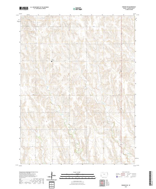
2022 Map of Edmond NW
USGS Topo · Published 2022About this map
Prairie Gem Cem stands as a lonely landmark in this high-plains landscape of Norton County, providing a vital point of reference for genealogists and local historians. The terrain is defined by the dendritic drainage patterns of E Elk Cr and Sand Cr, which carve through the sectional grid of the Kansas prairie. These seasonal watercourses dictate the subtle shifts in elevation that separate the vast agricultural tracts. The map's strictly rectangular road network, featuring labels like Road S, Rd U, and Rd X, underscores the enduring influence of the Public Land Survey System on the region's development. This 2022 dataset captures the area's modern topography while preserving the locations of historical features like the cemetery, which remains a rare physical link to the early families of the Edmond vicinity.
Find a feature on this map
16 named features on this map. Tap any name to fly to it.
Don’t see what you’re looking for? This feature index may not catch every label — zoom into the map to look around manually.
Map Details
Editions of this 2022 Edmond NW Map
This is the sole edition of this map. No revisions or reprints were ever made.
Other maps of this area

1893 · Norton
USGS Topo · 1:125,000

1951 · Norton
USGS Topo · 1:62,500

1951 · Norcatur
USGS Topo · 1:62,500

1954 · Goodland
USGS Topo · 1:250,000

1955 · Beloit
USGS Topo · 1:250,000

1956 · Goodland
USGS Topo · 1:250,000

1957 · Goodland
USGS Topo · 1:250,000

1959 · Beloit
USGS Topo · 1:250,000
1978 · Calvert
USGS Topo · 1:24,000

1978 · Edmond
USGS Topo · 1:24,000