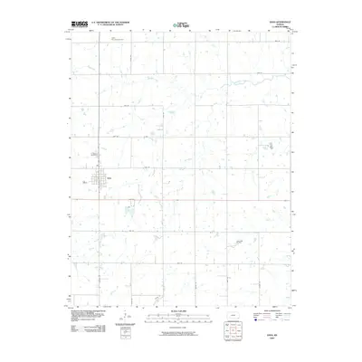
2009 Map of Edna
USGS Topo · Published 2009About this map
Edna serves as the central hub for this portion of Labette County, organized by a precise grid of rural roads like 9000 Rd and Nation Rd. The landscape is defined by the drainage patterns of numerous waterways, including Rock Creek, Hackberry Creek, and Elm Creek, which wind through the agricultural sections. To the north of the town center lies the Edna Municipal Airport, while the Edna Cemetery is situated on the western edge of the community. A distinct shift in land use is visible in the southeastern quadrant, where the Lake Creek Oil Field indicates the region's historical and ongoing ties to the petroleum industry. This survey provides a clear view of the rural infrastructure and energy extraction footprint in Southeast Kansas during the early 21st century.
Find a feature on this map
24 named features on this map. Tap any name to fly to it.
Don’t see what you’re looking for? This feature index may not catch every label — zoom into the map to look around manually.
Map Details
Editions of this 2009 Edna Map
This is the sole edition of this map. No revisions or reprints were ever made.
Other maps of this area

1886 · Parsons
USGS Topo · 1:125,000

1893 · Parsons
USGS Topo · 1:125,000

1901 · Vinita
USGS Topo · 1:125,000

1913 · Vinita
USGS Topo · 1:125,000

1944 · Oswego
USGS Topo · 1:62,500

1946 · Oswego
USGS Topo · 1:48,000

1946 · Mound Valley
USGS Topo · 1:62,500

1947 · Joplin
USGS Topo · 1:250,000
1948 · Oswego
USGS Topo · 1:62,500
1948 · Mound Valley
USGS Topo · 1:62,500