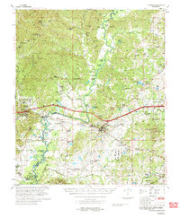
1975 Map of Edwards
USGS Topo · Published 1976About this map
The Big Black River meanders across this mid-1970s landscape, serving as the natural boundary between Warren and Hinds counties. The town of Edwards serves as a central hub, where the Illinois Central Gulf railroad and regional roads converge. The map documents a deeply rooted rural community, evidenced by numerous small country churches such as Mt Shiloh Ch and Bethlehem Ch, alongside family-named burial grounds like Birdsong Cem and Parker Cem.
Find a feature on this map
73 named features on this map. Tap any name to fly to it.
Don’t see what you’re looking for? This feature index may not catch every label — zoom into the map to look around manually.
Map Details
Editions of this 1975 Edwards Map
This is the sole edition of this map. No revisions or reprints were ever made.
Other maps of this area

1903 · Jackson
USGS Topo · 1:125,000

1918 · Vicksburg
USGS Topo · 1:62,500

1934 · Raymond
USGS Topo · 1:48,000

1937 · Raymond
USGS Topo · 1:62,500

1937 · Terry
USGS Topo · 1:48,000

1938 · Edwards
USGS Topo · 1:62,500

1939 · Onward
USGS Topo · 1:62,500

1939 · Yokena
USGS Topo · 1:62,500

1940 · Mechanicsburg
USGS Topo · 1:62,500

1941 · Vicksburg
USGS Topo · 1:62,500