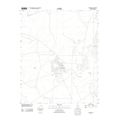
2012 Map of Edwards
USGS Topo · Published 2012About this map
Edwards Air Force Base dominates this high-desert landscape in Kern County, illustrating the specialized infrastructure of one of the world's most significant aerospace testing sites. The layout shows the residential heart of the base at Edwards, including the Wherry Housing district and the local Post Office, nestled between the Bissell Hills and the expansive dry bed of Rogers Lake. The map details the transition from residential areas to operational zones, featuring the Muroc Golf Course and specialized landmarks like the West Fly-By Tower. Roads such as Neuralia Rd and E Trotter Ave provide a skeletal grid across the arid terrain, leading toward the Edwards Air Force Sta. This 2012 survey captures the modern footprint of the base, preserving the locations of military housing and tactical observation points used in flight testing programs.
Find a feature on this map
11 named features on this map. Tap any name to fly to it.
Don’t see what you’re looking for? This feature index may not catch every label — zoom into the map to look around manually.
Map Details
Editions of this 2012 Edwards Map
This is the sole edition of this map. No revisions or reprints were ever made.
Other maps of this area

1915 · Elizabeth Lake
USGS Topo · 1:125,000

1915 · Searles Lake
USGS Topo · 1:250,000

1915 · Mojave
USGS Topo · 1:125,000

1917 · Elizabeth Lake
USGS Topo · 1:125,000

1937 · Rogers Lake
USGS Topo · 1:48,000

1942 · Rogers Lake
USGS Topo · 1:62,500

1943 · Rosamond
USGS Topo · 1:62,500

1943 · Castle Butte
USGS Topo · 1:62,500

1943 · Mojave
USGS Topo · 1:62,500

1947 · Fluhr
USGS Topo · 1:24,000