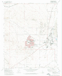
1973 Map of Edwards
USGS Topo · Published 1976About this map
The Air Force Flight Test Center at Edwards Air Force Base dominates this mid-1970s landscape, serving as a critical hub for American aerospace development. The map reveals the intricate infrastructure of the base, from the sprawling Rogers Lake shoreline to the specialized facilities of the NASA Flight Research Center. Residential life for military families is centered in the town of Edwards, which features several educational institutions including Bailey Sch, Payne Sch, and Forbes Ave Sch.
Find a feature on this map
44 named features on this map. Tap any name to fly to it.
Don’t see what you’re looking for? This feature index may not catch every label — zoom into the map to look around manually.
Map Details
Editions of this 1973 Edwards Map
This is the sole edition of this map. No revisions or reprints were ever made.
Other maps of this area

1915 · Elizabeth Lake
USGS Topo · 1:125,000

1915 · Searles Lake
USGS Topo · 1:250,000

1915 · Mojave
USGS Topo · 1:125,000

1917 · Elizabeth Lake
USGS Topo · 1:125,000

1937 · Rogers Lake
USGS Topo · 1:48,000

1942 · Rogers Lake
USGS Topo · 1:62,500

1943 · Rosamond
USGS Topo · 1:62,500

1943 · Castle Butte
USGS Topo · 1:62,500

1943 · Mojave
USGS Topo · 1:62,500

1947 · Fluhr
USGS Topo · 1:24,000