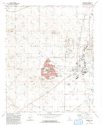
1992 Map of Edwards
USGS Topo · Published 1992About this map
Edwards Air Force Base occupies this high desert landscape, serving as a critical hub for aviation development. The map details the extensive infrastructure of the Edwards Air Force Flight Test Center, including the specialized NASA Ames-Dryden Flight Research Facility positioned along the edge of the Rogers Lake playa. The residential core of Edwards is clearly defined, showing a network of streets like Mojave Blvd and Bailey Ave serving local families and personnel. Education is centralized within the base at sites such as Desert HS and Payne Jr HS. The surrounding terrain transitions from the developed airfield and tracking facilities to the natural rises of the Bissell Hills and Rosamond Hills, highlighting the isolation required for flight testing operations.
Find a feature on this map
47 named features on this map. Tap any name to fly to it.
Don’t see what you’re looking for? This feature index may not catch every label — zoom into the map to look around manually.
Map Details
Editions of this 1992 Edwards Map
This is the sole edition of this map. No revisions or reprints were ever made.
Other maps of this area

1915 · Elizabeth Lake
USGS Topo · 1:125,000

1915 · Searles Lake
USGS Topo · 1:250,000

1915 · Mojave
USGS Topo · 1:125,000

1917 · Elizabeth Lake
USGS Topo · 1:125,000

1937 · Rogers Lake
USGS Topo · 1:48,000

1942 · Rogers Lake
USGS Topo · 1:62,500

1943 · Rosamond
USGS Topo · 1:62,500

1943 · Castle Butte
USGS Topo · 1:62,500

1943 · Mojave
USGS Topo · 1:62,500

1947 · Fluhr
USGS Topo · 1:24,000