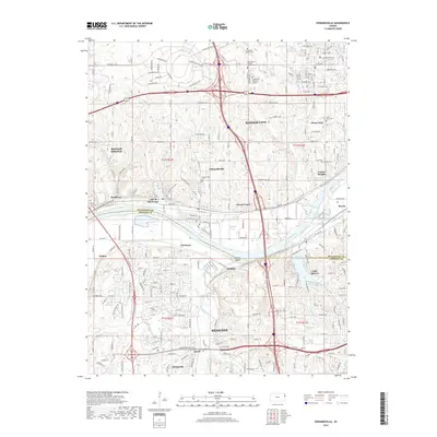
2018 Map of Edwardsville
USGS Topo · Published 2018About this map
Bonner Springs and Kansas City anchor this 2018 survey of the borderlands between Wyandotte and Johnson counties. The landscape is defined by the winding course of the Kansas River, which separates established industrial and residential corridors from the recreational waters of Lake Quivira and Lake of the Forest. Numerous small communities and neighborhoods such as Edwardsville, Grinter Heights, and Sunflower are interspersed with significant local landmarks including Nelson Island. A high concentration of cemeteries, such as the Stony Point Cem, Grinter Cem, and Edwardsville Cem, provides a detailed record of the area's social history. The road network, featuring Kaw Dr and Shawnee Mission Pkwy, highlights the transition between suburban development and the natural drainages of Mill Creek and Little Turkey Creek.
Find a feature on this map
46 named features on this map. Tap any name to fly to it.
Don’t see what you’re looking for? This feature index may not catch every label — zoom into the map to look around manually.
Map Details
Editions of this 2018 Edwardsville Map
This is the sole edition of this map. No revisions or reprints were ever made.
Other maps of this area

1887 · Olathe
USGS Topo · 1:125,000

1890 · Kansas City
USGS Topo · 1:125,000

1893 · Olathe
USGS Topo · 1:125,000

1894 · Kansas City
USGS Topo · 1:125,000

1934 · Bonner Springs
USGS Topo · 1:48,000

1934 · Shawnee
USGS Topo · 1:24,000

1934 · Edwardsville
USGS Topo · 1:24,000

1934 · Wolcott
USGS Topo · 1:24,000

1935 · Olathe
USGS Topo · 1:24,000

1935 · Lenexa
USGS Topo · 1:24,000