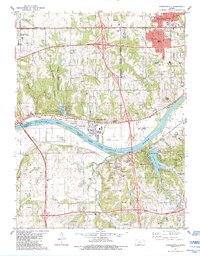
1984 Map of Edwardsville
USGS Topo · Published 1984About this map
The Kansas River carves a winding path through this portion of the Kansas City metropolitan area, serving as a distinct boundary between Wyandotte and Johnson counties. Along its northern banks, Edwardsville and Grinter Heights sit adjacent to a heavy industrial and transportation corridor defined by the Union Pacific rail lines and extensive quarry operations. To the south, the landscape shifts toward the expanding residential and recreational developments of Shawnee Township and Monticello Township, where planned communities like Lake Quivira and Lake of the Forest are prominent.
Find a feature on this map
82 named features on this map. Tap any name to fly to it.
Don’t see what you’re looking for? This feature index may not catch every label — zoom into the map to look around manually.
Map Details
Editions of this 1984 Edwardsville Map
This is the sole edition of this map. No revisions or reprints were ever made.
Other maps of this area

1887 · Olathe
USGS Topo · 1:125,000

1890 · Kansas City
USGS Topo · 1:125,000

1893 · Olathe
USGS Topo · 1:125,000

1894 · Kansas City
USGS Topo · 1:125,000

1934 · Bonner Springs
USGS Topo · 1:48,000

1934 · Shawnee
USGS Topo · 1:24,000

1934 · Edwardsville
USGS Topo · 1:24,000

1934 · Wolcott
USGS Topo · 1:24,000

1935 · Olathe
USGS Topo · 1:24,000

1935 · Lenexa
USGS Topo · 1:24,000