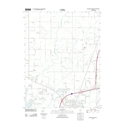
2012 Map of Effingham North
USGS Topo · Published 2012About this map
Effingham City Cemetery and the northern outskirts of the city center anchor the southern edge of this landscape, where residential growth meets the rural Illinois countryside. The terrain is defined by the winding paths of the Little Wabash River and its numerous tributaries, including Hog Creek, Salt Creek, and Sugar Fork. This 2012 survey illustrates a transition from established urban infrastructure to a landscape of named agricultural operations such as Greuel Dairy Farm, Tebbe Farms, and Henry Farms. Water management is prominent here, seen in the western reach of Lake Sara and the smaller Lake Pauline. For local historians, the map provides a precise layout of several regional burial grounds, including Mound Cemetery, Ramsey Cemetery, and the Saint Anthony Catholic Cemetery, offering a detailed look at the geographic distribution of family sites across the prairie.
Find a feature on this map
73 named features on this map. Tap any name to fly to it.
Don’t see what you’re looking for? This feature index may not catch every label — zoom into the map to look around manually.
Map Details
Editions of this 2012 Effingham North Map
This is the sole edition of this map. No revisions or reprints were ever made.
Other maps of this area

1934 · Mattoon
USGS Topo · 1:62,500

1937 · Mattoon
USGS Topo · 1:62,500

1947 · Stewardson
USGS Topo · 1:62,500

1949 · Stewardson
USGS Topo · 1:62,500

1950 · Effingham
USGS Topo · 1:62,500

1951 · Effingham
USGS Topo · 1:62,500

1953 · Teutopolis
USGS Topo · 1:62,500

1958 · Decatur
USGS Topo · 1:250,000

1961 · Decatur
USGS Topo · 1:250,000
1981 · Stewardson East
USGS Topo · 1:24,000