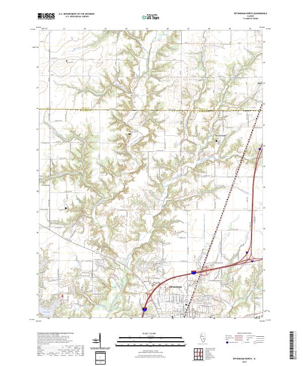
2024 Map of Effingham North
USGS Topo · Published 2024About this map
The city of Effingham serves as the major hub in this 2024 map, situated at a critical crossroads where the sprawling residential developments of Lake Sara meet the riverine landscape of the Little Wabash River. The map documents a transition from the dense street grids of the city to the structured agricultural layout of the Shelby Co Effingham Co border. Rural life is anchored by established community markers, including Sigel in the northeast and Green Creek to the south. Numerous burial grounds, such as Mound Cem, Ramsey Cem, and Saint Marys Cem, are interspersed among the drainages of Hog Creek, Rattlesnake Creek, and Shoal Creek. These features, along with the larger Oakridge Cem and Saint Anthony Cem near the city center, provide essential coordinates for local historians and genealogists tracing family roots across these central Illinois townships.
Find a feature on this map
75 named features on this map. Tap any name to fly to it.
Don’t see what you’re looking for? This feature index may not catch every label — zoom into the map to look around manually.
Map Details
Editions of this 2024 Effingham North Map
This is the sole edition of this map. No revisions or reprints were ever made.
Other maps of this area

1934 · Mattoon
USGS Topo · 1:62,500

1937 · Mattoon
USGS Topo · 1:62,500

1947 · Stewardson
USGS Topo · 1:62,500

1949 · Stewardson
USGS Topo · 1:62,500

1950 · Effingham
USGS Topo · 1:62,500

1951 · Effingham
USGS Topo · 1:62,500

1953 · Teutopolis
USGS Topo · 1:62,500

1958 · Decatur
USGS Topo · 1:250,000

1961 · Decatur
USGS Topo · 1:250,000
1981 · Stewardson East
USGS Topo · 1:24,000