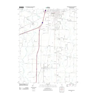
2012 Map of Effingham South
USGS Topo · Published 2012About this map
Effingham serves as the northern anchor of this Illinois landscape, where the urban grid meets the agricultural reaches of southern Effingham County. The Little Wabash River and Salt Cr dominate the natural drainage, carving through a region marked by long-standing farmsteads like Bourgeois Farms and Feldhake Dairy. Local history and genealogy are deeply rooted here, evidenced by numerous burial grounds including Ewington Cem, Arborcrest Cem, and Toothaker Cem.
Find a feature on this map
154 named features on this map. Tap any name to fly to it.
Don’t see what you’re looking for? This feature index may not catch every label — zoom into the map to look around manually.
Map Details
Editions of this 2012 Effingham South Map
This is the sole edition of this map. No revisions or reprints were ever made.
Other maps of this area

1950 · Effingham
USGS Topo · 1:62,500

1951 · Effingham
USGS Topo · 1:62,500

1953 · Teutopolis
USGS Topo · 1:62,500

1953 · Sailor Springs
USGS Topo · 1:62,500

1956 · Edgewood
USGS Topo · 1:62,500

1958 · Decatur
USGS Topo · 1:250,000

1958 · Belleville
USGS Topo · 1:250,000

1961 · Decatur
USGS Topo · 1:250,000

1962 · Belleville
USGS Topo · 1:250,000
1985 · Hord
USGS Topo · 1:24,000