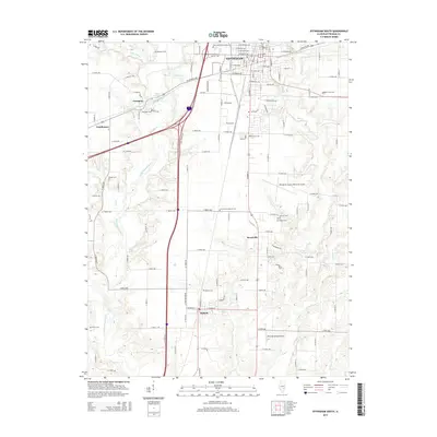
2015 Map of Effingham South
USGS Topo · Published 2015About this map
The Little Wabash River and its varied tributaries, including Blue Point Cr and Salt Cr, shape the landscape south of the city of Effingham. This 2015 survey details the transit-oriented development of the region, where the corridors of Interstate 57 and Interstate 70 intersect near the Little Wabash River Reservoir. Beyond the city limits, the map documents smaller settlements like Watson, Heartville, Ewington, and Funkhouser, each maintaining its distinct identity amid the agricultural grid of Effingham County.
Find a feature on this map
117 named features on this map. Tap any name to fly to it.
Don’t see what you’re looking for? This feature index may not catch every label — zoom into the map to look around manually.
Map Details
Editions of this 2015 Effingham South Map
This is the sole edition of this map. No revisions or reprints were ever made.
Other maps of this area

1950 · Effingham
USGS Topo · 1:62,500

1951 · Effingham
USGS Topo · 1:62,500

1953 · Teutopolis
USGS Topo · 1:62,500

1953 · Sailor Springs
USGS Topo · 1:62,500

1956 · Edgewood
USGS Topo · 1:62,500

1958 · Decatur
USGS Topo · 1:250,000

1958 · Belleville
USGS Topo · 1:250,000

1961 · Decatur
USGS Topo · 1:250,000

1962 · Belleville
USGS Topo · 1:250,000
1985 · Hord
USGS Topo · 1:24,000