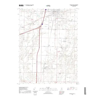
2018 Map of Effingham South
USGS Topo · Published 2018About this map
Effingham anchors the northern edge of this Illinois landscape, where the urban grid of streets like W Jefferson Ave and E Fayette Ave meets the rural agricultural expanse of Effingham County. The region is defined by the branching drainage of the Little Wabash River and its numerous tributaries, including Salt Cr and Lily Cr. Smaller settlements such as Watson and Funkhouser serve as local hubs, connected by a network of county roads like Country Club Rd and Pike Ave. Genealogists will find a wealth of burial sites throughout the townships, from the Saint John Lutheran Cem near the city center to the more isolated Ewington Cem and Porter Cem. The presence of the Effingham County Memorial Airport and Percival Springs Airport highlights the area's role in regional aviation, while bodies of water like Cips Lake and the edges of Lake Sara provide distinct geographic landmarks.
Find a feature on this map
92 named features on this map. Tap any name to fly to it.
Don’t see what you’re looking for? This feature index may not catch every label — zoom into the map to look around manually.
Map Details
Editions of this 2018 Effingham South Map
This is the sole edition of this map. No revisions or reprints were ever made.
Other maps of this area

1950 · Effingham
USGS Topo · 1:62,500

1951 · Effingham
USGS Topo · 1:62,500

1953 · Teutopolis
USGS Topo · 1:62,500

1953 · Sailor Springs
USGS Topo · 1:62,500

1956 · Edgewood
USGS Topo · 1:62,500

1958 · Decatur
USGS Topo · 1:250,000

1958 · Belleville
USGS Topo · 1:250,000

1961 · Decatur
USGS Topo · 1:250,000

1962 · Belleville
USGS Topo · 1:250,000
1985 · Hord
USGS Topo · 1:24,000