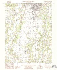
1985 Map of Effingham South
USGS Topo · Published 1985About this map
The city of Effingham serves as the industrial and transportation hub for this mid-1980s landscape, where the Illinois Central Gulf Railroad and Conrail lines intersect. The map documents a period of significant local infrastructure, including the Effingham County Memorial Airport and a series of Industrial Waste Ponds that hint at the era's manufacturing footprint. Beyond the urban center, the terrain is defined by the winding course of the Little Wabash River, which separates the township of Summit from the surrounding countryside. Smaller rural settlements like Watson, Heartville, and Teutopolis are mapped in detail, often clustered around rail corridors or water sources like Blue Point Creek. For local historians, the inclusion of old town sites like Ewington and Funkhouser provides a clear view of the shifting population centers in Effingham County.
Find a feature on this map
28 named features on this map. Tap any name to fly to it.
Don’t see what you’re looking for? This feature index may not catch every label — zoom into the map to look around manually.
Map Details
Editions of this 1985 Effingham South Map
This is the sole edition of this map. No revisions or reprints were ever made.
Other maps of this area

1950 · Effingham
USGS Topo · 1:62,500

1951 · Effingham
USGS Topo · 1:62,500

1953 · Teutopolis
USGS Topo · 1:62,500

1953 · Sailor Springs
USGS Topo · 1:62,500

1956 · Edgewood
USGS Topo · 1:62,500

1958 · Decatur
USGS Topo · 1:250,000

1958 · Belleville
USGS Topo · 1:250,000

1961 · Decatur
USGS Topo · 1:250,000

1962 · Belleville
USGS Topo · 1:250,000
1985 · Hord
USGS Topo · 1:24,000