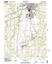
1998 Map of Effingham South
USGS Topo · Published 2002About this map
The city of Effingham serves as the focal point of this late 20th-century survey, situated at the busy crossroads of major interstate interchanges and regional infrastructure. The landscape south of the city reveals a transition from urban development to rural township grids, where the Little Wabash River meanders through the western townships of Summit and Jackson. This waterway, along with Salt Creek and Brush Creek to the east, dictates the natural drainage patterns that shaped the area's early agricultural settlement.
Find a feature on this map
37 named features on this map. Tap any name to fly to it.
Don’t see what you’re looking for? This feature index may not catch every label — zoom into the map to look around manually.
Map Details
Editions of this 1998 Effingham South Map
This is the sole edition of this map. No revisions or reprints were ever made.
Other maps of this area

1950 · Effingham
USGS Topo · 1:62,500

1951 · Effingham
USGS Topo · 1:62,500

1953 · Teutopolis
USGS Topo · 1:62,500

1953 · Sailor Springs
USGS Topo · 1:62,500

1956 · Edgewood
USGS Topo · 1:62,500

1958 · Decatur
USGS Topo · 1:250,000

1958 · Belleville
USGS Topo · 1:250,000

1961 · Decatur
USGS Topo · 1:250,000

1962 · Belleville
USGS Topo · 1:250,000
1985 · Hord
USGS Topo · 1:24,000