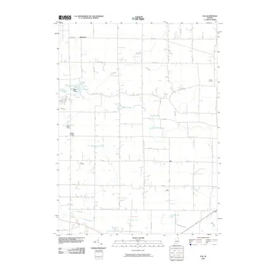
2010 Map of Ege
USGS Topo · Published 2010About this map
Green Center and the surrounding agricultural landscapes of Noble and Whitley Counties are defined by an intricate network of drainage ditches and glacial kettle lakes. Small rural settlements like Bakertown, Ege, and Ari anchor the township grid, connected by a strictly rectilinear road system including Hopewell Rd and E Baseline Rd. The terrain is shaped by the Blue River and numerous watercourses like Willow Creek and Growcock Branch, which feed into local landmarks such as McHenry Lake and Fulk Lake. For local historians and genealogists, the presence of several established burial grounds, including Hooper Cemetery, Grays Cemetery, and Fulk Cemetery, provides a clear view of the area's ancestral footprint. The map also features the Green Center Airport, highlighting the continued utility of this rural Indiana countryside into the modern era.
Find a feature on this map
43 named features on this map. Tap any name to fly to it.
Don’t see what you’re looking for? This feature index may not catch every label — zoom into the map to look around manually.
Map Details
Editions of this 2010 Ege Map
This is the sole edition of this map. No revisions or reprints were ever made.
Other maps of this area

1951 · Merriam
USGS Topo · 1:24,000

1953 · Fort Wayne
USGS Topo · 1:250,000

1955 · Corunna
USGS Topo · 1:24,000

1955 · Columbia City
USGS Topo · 1:24,000

1955 · Ege
USGS Topo · 1:24,000

1955 · Kendallville
USGS Topo · 1:24,000

1956 · Fort Wayne
USGS Topo · 1:250,000

1956 · Albion
USGS Topo · 1:24,000

1957 · Huntertown
USGS Topo · 1:24,000

1957 · Garrett
USGS Topo · 1:24,000