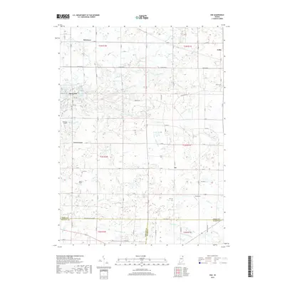
2019 Map of Ege
USGS Topo · Published 2019About this map
Egans Point and the complex of small water bodies like Long Lake and Dock Lake define the glaciated terrain north of Green Center. This 2019 survey documents a landscape where traditional drainage networks, such as Summers Ditch and Thumma Ditch, support an agricultural and residential patchwork at the intersection of Noble, Whitley, and Allen counties. Small aviation fields like Pippenger Airport and Resler Airport are scattered throughout the countryside, reflecting the area's modern utility and connectivity. Genealogy researchers will find several family-named burial sites, including Hooper Cem near Avilla and Fulk Cem north of Fulk Lake. The southern boundary reveals the headwaters of the Blue River and several namesake waterways like Growcock Br and Wappes Ditch, which drain the lowlands surrounding the crossroads of Ege.
Find a feature on this map
70 named features on this map. Tap any name to fly to it.
Don’t see what you’re looking for? This feature index may not catch every label — zoom into the map to look around manually.
Map Details
Editions of this 2019 Ege Map
This is the sole edition of this map. No revisions or reprints were ever made.
Other maps of this area

1951 · Merriam
USGS Topo · 1:24,000

1953 · Fort Wayne
USGS Topo · 1:250,000

1955 · Corunna
USGS Topo · 1:24,000

1955 · Columbia City
USGS Topo · 1:24,000

1955 · Ege
USGS Topo · 1:24,000

1955 · Kendallville
USGS Topo · 1:24,000

1956 · Fort Wayne
USGS Topo · 1:250,000

1956 · Albion
USGS Topo · 1:24,000

1957 · Huntertown
USGS Topo · 1:24,000

1957 · Garrett
USGS Topo · 1:24,000