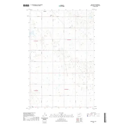
2020 Map of Egeland SE
USGS Topo · Published 2020About this map
Egeland sits at the northern edge of this North Dakota landscape, a region defined by the intricate prairie pothole topography of Towner County. The survey captures a high-resolution view of the local drainage and wetland patterns, most notably the seasonal waterway of Big Coulee in the southwest. A grid of section-line roads, including Egeland Rd and 75th St NE, provides access to the surrounding agricultural land. Genealogists will find the Egeland Union Cem clearly marked near the town site, offering a specific point of reference for family research in this rural district. The map reflects the enduring township and range system, documenting the boundaries of T159N, T158N, R66W, and R65W as they appeared in 2020.
Find a feature on this map
22 named features on this map. Tap any name to fly to it.
Don’t see what you’re looking for? This feature index may not catch every label — zoom into the map to look around manually.
Map Details
Editions of this 2020 Egeland SE Map
This is the sole edition of this map. No revisions or reprints were ever made.
Other maps of this area

1953 · Devils Lake
USGS Topo · 1:250,000

1956 · Devils Lake
USGS Topo · 1:250,000

1957 · Cando
USGS Topo · 1:24,000

1957 · Cando NE
USGS Topo · 1:24,000

1962 · Egeland SE
USGS Topo · 1:24,000

1962 · Egeland SW
USGS Topo · 1:24,000

1962 · Starkweather
USGS Topo · 1:24,000

1962 · Egeland
USGS Topo · 1:24,000

1962 · Snyder Lake
USGS Topo · 1:24,000

1971 · Calio
USGS Topo · 1:24,000