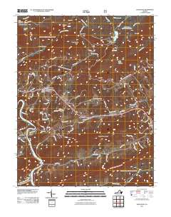
2011 Map of Eggleston
USGS Topo · Published 2011About this map
New River carves a deep path through this Virginia landscape, anchored by the riverside settlements of Eggleston and Berton. The terrain is defined by high ridges like Butt Mountain and Johns Creek Mountain, which frame a complex hydrologic system featuring the natural Mountain Lake and the unusual drainage patterns of Creek Sinks. Local history is visible in the network of rural roads such as Old Stage Rd and Old Ferry Rd, connecting generational landmarks like Hoges Chapel and several community burial grounds including Boyds Chapel Cemetery. The presence of Goodwins Ferry on the river and the Cascades Picnic Area near Little Stony Creek highlights the area's long-standing relationship between its water resources and the local population. Researchers will find a rural landscape where traditional mountain geography meets historical river crossings and established church communities.
Find a feature on this map
85 named features on this map. Tap any name to fly to it.
Don’t see what you’re looking for? This feature index may not catch every label — zoom into the map to look around manually.
Map Details
Editions of this 2011 Eggleston Map
This is the sole edition of this map. No revisions or reprints were ever made.
Other maps of this area

1890 · Dublin
USGS Topo · 1:125,000

1890 · Christiansburg
USGS Topo · 1:125,000

1891 · Dublin
USGS Topo · 1:125,000

1923 · Pearisburg
USGS Topo · 1:62,500

1923 · Waiteville
USGS Topo · 1:62,500

1931 · Waiteville
USGS Topo · 1:48,000

1932 · Pearisburg
USGS Topo · 1:48,000

1932 · Blacksburg
USGS Topo · 1:48,000

1937 · Pearisburg
USGS Topo · 1:62,500

1937 · Blacksburg
USGS Topo · 1:62,500