
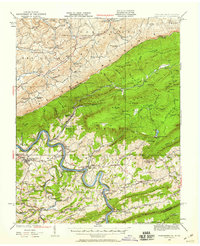
1932 Map of Pearisburg
USGS Topo · Published 1932About this map
New River carves a winding path through the center of this Giles County landscape, serving as a primary corridor for small settlements like Pearisburg, Pembroke, and Eggleston. The map captures a transition from the river valley floor to high ridges, notably Peters Mountain along the West Virginia border and the expansive Butt Mountain interior. For the family historian, the sheet is exceptionally detailed with community infrastructure, showing a dense network of local schools such as Broad Hollow Sch and Painter Sch, alongside spiritual centers like Sherry Memorial Ch and Boyd Chapel. Movement across the terrain was defined by landmarks like Goodwins Ferry and the Blue Grass Trail, while the high-elevation Mountain Lake stands out as a unique geographic feature atop the mountainside. The inclusion of a Transmission Line and numerous named gaps illustrates the 1930s integration of modern utilities and traditional mountain passages.
Find a feature on this map
67 named features on this map. Tap any name to fly to it.
Don’t see what you’re looking for? This feature index may not catch every label — zoom into the map to look around manually.
Map Details
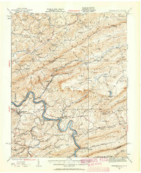
Editions of this 1932 Pearisburg Map
3 editions found
Other maps of this area

1887 · Hinton
USGS Topo · 1:125,000

1887 · Lewisburg
USGS Topo · 1:125,000

1890 · Dublin
USGS Topo · 1:125,000

1890 · Christiansburg
USGS Topo · 1:125,000

1891 · Lewisburg
USGS Topo · 1:125,000

1891 · Dublin
USGS Topo · 1:125,000

1892 · Hinton
USGS Topo · 1:125,000

1912 · Big Bend
USGS Topo · 1:62,500

1913 · Peterstown
USGS Topo · 1:48,000

1914 · Big Bend
USGS Topo · 1:62,500