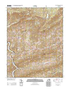
2013 Map of Eggleston
USGS Topo · Published 2013About this map
Mountain Lake sits high on the slopes of Johns Creek Mountain, serving as a focal point for this 2013 landscape in Giles County. The survey illustrates a terrain defined by sharp elevation changes, from the heights of Butt Mountain and Barneys Wall down to the banks of the New River at Eggleston. The drainage patterns here are particularly notable, specifically where Sinking Cr disappears into the Creek Sinks, a geologic feature characteristic of the region's karst topography.
Find a feature on this map
110 named features on this map. Tap any name to fly to it.
Don’t see what you’re looking for? This feature index may not catch every label — zoom into the map to look around manually.
Map Details
Editions of this 2013 Eggleston Map
This is the sole edition of this map. No revisions or reprints were ever made.
Other maps of this area

1890 · Dublin
USGS Topo · 1:125,000

1890 · Christiansburg
USGS Topo · 1:125,000

1891 · Dublin
USGS Topo · 1:125,000

1923 · Pearisburg
USGS Topo · 1:62,500

1923 · Waiteville
USGS Topo · 1:62,500

1931 · Waiteville
USGS Topo · 1:48,000

1932 · Pearisburg
USGS Topo · 1:48,000

1932 · Blacksburg
USGS Topo · 1:48,000

1937 · Pearisburg
USGS Topo · 1:62,500

1937 · Blacksburg
USGS Topo · 1:62,500