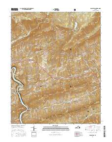
2016 Map of Eggleston
USGS Topo · Published 2016About this map
The New River winds through the southwestern corner of this Giles County landscape, anchoring a region defined by dramatic elevation changes within the Jefferson National Forest. Settlement patterns follow the valley floors, with the communities of Pembroke, Eggleston, and Maybrook situated along the lower elevations. The geography is notable for its numerous family and community landmarks, such as Hoges Chapel and its associated Hoges Chapel Cem, alongside Mount Lebanon Cem. In the north, Mountain Lake sits high above the surrounding peaks of Johns Creek Mtn and Doe Mtn. A distinctive geological feature, the Creek Sinks, illustrates the complex drainage of Sinking Creek as it moves through the central valley. This detailed topographical record reveals the intersection of rural Virginia life and the steep ridges of the Appalachians, from the banks of the Spruce Run to the heights of Bald Knob.
Find a feature on this map
107 named features on this map. Tap any name to fly to it.
Don’t see what you’re looking for? This feature index may not catch every label — zoom into the map to look around manually.
Map Details
Editions of this 2016 Eggleston Map
This is the sole edition of this map. No revisions or reprints were ever made.
Other maps of this area

1890 · Dublin
USGS Topo · 1:125,000

1890 · Christiansburg
USGS Topo · 1:125,000

1891 · Dublin
USGS Topo · 1:125,000

1923 · Pearisburg
USGS Topo · 1:62,500

1923 · Waiteville
USGS Topo · 1:62,500

1931 · Waiteville
USGS Topo · 1:48,000

1932 · Pearisburg
USGS Topo · 1:48,000

1932 · Blacksburg
USGS Topo · 1:48,000

1937 · Pearisburg
USGS Topo · 1:62,500

1937 · Blacksburg
USGS Topo · 1:62,500