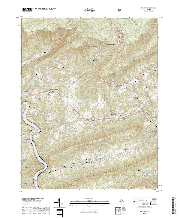
2022 Map of Eggleston
USGS Topo · Published 2022About this map
Mountain Lake sits high atop Salt Pond Mtn within the Jefferson National Forest, anchoring a landscape defined by sharp ridges and deep watercourses. To the southwest, the New River carves a deep valley past the settlements of Eggleston and Berton, where Goodwins Ferry Rd and New River Park Ln trace the riparian edge. The terrain is marked by significant geological features such as Creek Sinks and the high overlooks at Lookoff Rock and Bear Cliff.
Find a feature on this map
171 named features on this map. Tap any name to fly to it.
Don’t see what you’re looking for? This feature index may not catch every label — zoom into the map to look around manually.
Map Details
Editions of this 2022 Eggleston Map
This is the sole edition of this map. No revisions or reprints were ever made.
Other maps of this area

1890 · Dublin
USGS Topo · 1:125,000

1890 · Christiansburg
USGS Topo · 1:125,000

1891 · Dublin
USGS Topo · 1:125,000

1923 · Pearisburg
USGS Topo · 1:62,500

1923 · Waiteville
USGS Topo · 1:62,500

1931 · Waiteville
USGS Topo · 1:48,000

1932 · Pearisburg
USGS Topo · 1:48,000

1932 · Blacksburg
USGS Topo · 1:48,000

1937 · Pearisburg
USGS Topo · 1:62,500

1937 · Blacksburg
USGS Topo · 1:62,500