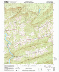
1998 Map of Eggleston
USGS Topo · Published 2000About this map
Goodwins Ferry and Eggleston anchor the western edge of this landscape where the New River carves through the Appalachian terrain. The map documents a rural network of small communities and religious centers, such as Hoges Chapel and Maybrook, connected by winding roads through the Jefferson National Forest. High-elevation landmarks like Bald Knob and the Mountain Lake Biological Station of University of Virginia overlook the waters of Mountain Lake. The area's limestone geology is evident in the numerous springs and the subterranean drainage of Sinking Creek. Local history and genealogy are preserved through numerous sites like the Lucas Memorial Cem Ch, Mt Lebanon Ch, and Newport Cem, reflecting the deep-rooted settlement patterns along Spruce Run and Doe Creek.
Find a feature on this map
55 named features on this map. Tap any name to fly to it.
Don’t see what you’re looking for? This feature index may not catch every label — zoom into the map to look around manually.
Map Details
Editions of this 1998 Eggleston Map
This is the sole edition of this map. No revisions or reprints were ever made.
Other maps of this area

1890 · Dublin
USGS Topo · 1:125,000

1890 · Christiansburg
USGS Topo · 1:125,000

1891 · Dublin
USGS Topo · 1:125,000

1923 · Pearisburg
USGS Topo · 1:62,500

1923 · Waiteville
USGS Topo · 1:62,500

1931 · Waiteville
USGS Topo · 1:48,000

1932 · Pearisburg
USGS Topo · 1:48,000

1932 · Blacksburg
USGS Topo · 1:48,000

1937 · Pearisburg
USGS Topo · 1:62,500

1937 · Blacksburg
USGS Topo · 1:62,500