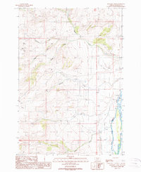
1988 Map of Eightmile Creek
USGS Topo · Published 1989About this map
The Madison River dominates the eastern edge of this landscape, serving as the primary corridor for movement and recreation. Near its banks, a Campground and Boat Ramp mark the intersection of the river with local travel routes, while a network of irrigation ditches suggests the importance of water management to the valley below. To the west, the terrain rises into higher country drained by Eightmile Creek, Postlewaite Creek, and Moran Creek.
Find a feature on this map
21 named features on this map. Tap any name to fly to it.
Don’t see what you’re looking for? This feature index may not catch every label — zoom into the map to look around manually.
Map Details
Editions of this 1988 Eightmile Creek Map
This is the sole edition of this map. No revisions or reprints were ever made.
Other maps of this area

1888 · Three Forks
USGS Topo · 1:250,000

1894 · Three Forks
USGS Topo · 1:250,000

1895 · Three Forks
USGS Topo · 1:250,000

1947 · Bozeman
USGS Topo · 1:250,000

1948 · Bozeman
USGS Topo · 1:250,000

1949 · Varney
USGS Topo · 1:62,500

1949 · Ennis
USGS Topo · 1:62,500

1950 · Cameron
USGS Topo · 1:62,500

1950 · Virginia City
USGS Topo · 1:62,500

1955 · Bozeman
USGS Topo · 1:250,000