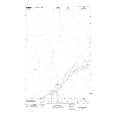
2011 Map of Eightmile Mountain
USGS Topo · Published 2011About this map
South Fork Payette River carves through this portion of Boise County, serving as the primary corridor for movement and recreation. Along its banks, the Bonneville Hot Springs and Warm Springs Campground mark established points for visitors entering from Grandjean Rd. The landscape is dominated by steep drainages, including Warm Spring Creek and Eightmile Creek, which flow toward the river from the flanks of Eightmile Mountain.
Find a feature on this map
22 named features on this map. Tap any name to fly to it.
Don’t see what you’re looking for? This feature index may not catch every label — zoom into the map to look around manually.
Map Details
Editions of this 2011 Eightmile Mountain Map
This is the sole edition of this map. No revisions or reprints were ever made.
Other maps of this area

1891 · Bear Valley
USGS Topo · 1:125,000

1893 · Bear Valley
USGS Topo · 1:125,000

1957 · Challis
USGS Topo · 1:250,000

1960 · Challis
USGS Topo · 1:250,000

1963 · Challis
USGS Topo · 1:250,000

1972 · Bull Trout Point
USGS Topo · 1:24,000
1972 · Banner Summit
USGS Topo · 1:24,000

1972 · Cache Creek
USGS Topo · 1:24,000
1972 · Tyee Mountain
USGS Topo · 1:24,000
1972 · Miller Mtn East
USGS Topo · 1:24,000