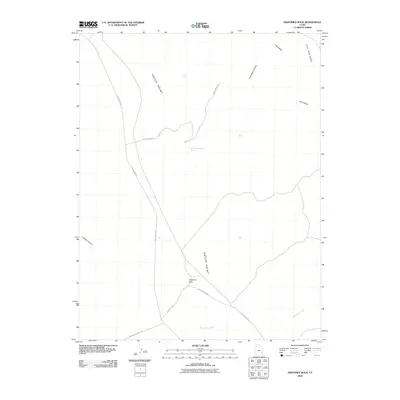
2010 Map of Eightmile Rock
USGS Topo · Published 2010About this map
Eightmile Rock serves as the central landmark for this high-desert plateau in San Juan County, where the vast drainage system of Hatch Wash and the elevated reach of Flat Iron Mesa dominate the terrain. The landscape is characterized by its reliance on isolated water sources like Rock Tank and Trout Water Canyon Spring, which are critical for navigation and land use in this arid region. A network of high-clearance routes, including Hatch Point Rd and the Hatch Point Spur, provides access across the prominent Hatch Point. These roads trace the contours of deep incisions such as Trout Water Canyon and Lockhart Canyon, reflecting the intricate relationship between topography and transit in the Utah canyonlands. The proximity to Needles Overlook Rd indicates the area's role as a threshold to the broader geological marvels of the region.
Find a feature on this map
14 named features on this map. Tap any name to fly to it.
Don’t see what you’re looking for? This feature index may not catch every label — zoom into the map to look around manually.
Map Details
Editions of this 2010 Eightmile Rock Map
This is the sole edition of this map. No revisions or reprints were ever made.
Other maps of this area

1885 · La Sal
USGS Topo · 1:250,000

1954 · Mt Peale 3 NW
USGS Topo · 1:24,000

1954 · Mt Peale 2 SW
USGS Topo · 1:24,000

1954 · Mt Peale 2 NW
USGS Topo · 1:24,000

1954 · Carlisle 4 NW
USGS Topo · 1:24,000

1954 · Carlisle 1 NE
USGS Topo · 1:24,000

1954 · Carlisle 1 SE
USGS Topo · 1:24,000

1954 · Carlisle 1 NW
USGS Topo · 1:24,000

1954 · Carlisle 4 NE
USGS Topo · 1:24,000

1954 · Carlisle 1 SW
USGS Topo · 1:24,000