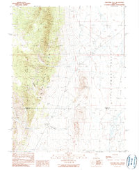
1990 Map of Eightmile Well
USGS Topo · Published 1990About this map
The Fish Creek Range dominates this central Nevada landscape, rising sharply above the Little Smoky Valley to the east. By the late 1980s, this area on the boundary of Eureka Co and Nye Co remained largely a high-desert wilderness defined by isolated water sources and mining exploration. Numerous Prospect and Prospects labels scattered along Bison Ridge and the mountain flanks indicate the persistent search for mineral wealth in the carbonate rocks of the range. Down in the valley, the presence of Eightmile Well and Cockalorum Spring highlights the critical importance of reliable water in an arid environment otherwise dominated by shifting Sand and ephemeral washes. Named high points like Bellevue Peak and Moody Peak provide significant navigational landmarks in a region where few permanent settlements exist beyond ranching outposts like Snowball Ranch.
Find a feature on this map
18 named features on this map. Tap any name to fly to it.
Don’t see what you’re looking for? This feature index may not catch every label — zoom into the map to look around manually.
Map Details
Editions of this 1990 Eightmile Well Map
This is the sole edition of this map. No revisions or reprints were ever made.
Other maps of this area

1926 · Roberts Mountains
USGS Topo · 1:250,000

1929 · Roberts Mountains
USGS Topo · 1:250,000

1953 · Pinto Summit
USGS Topo · 1:62,500

1955 · Millett
USGS Topo · 1:250,000

1956 · Bellevue Peak
USGS Topo · 1:62,500

1956 · Cockalorum Wash
USGS Topo · 1:62,500

1956 · Ely
USGS Topo · 1:250,000

1959 · Ely
USGS Topo · 1:250,000

1959 · Millett
USGS Topo · 1:250,000

1963 · Ely
USGS Topo · 1:250,000